Cycle Networking
A few days ago I came across this BBC news story that talks about the Slow Ways project which is an attempt to create “a pedestrian highway system, a slow alternative to our main roads and motorways”. This is such a good idea and it’s been going round in my head ever since, especially with regard to extending the idea to cycleways. The specific point that the Slow Ways project makes is that they aren’t looking for scenic routes - those are already available in the form of long distance pathways - these are practical walking routes between towns and villages. A laudable aim and I wish them well, but I want to go by bike.
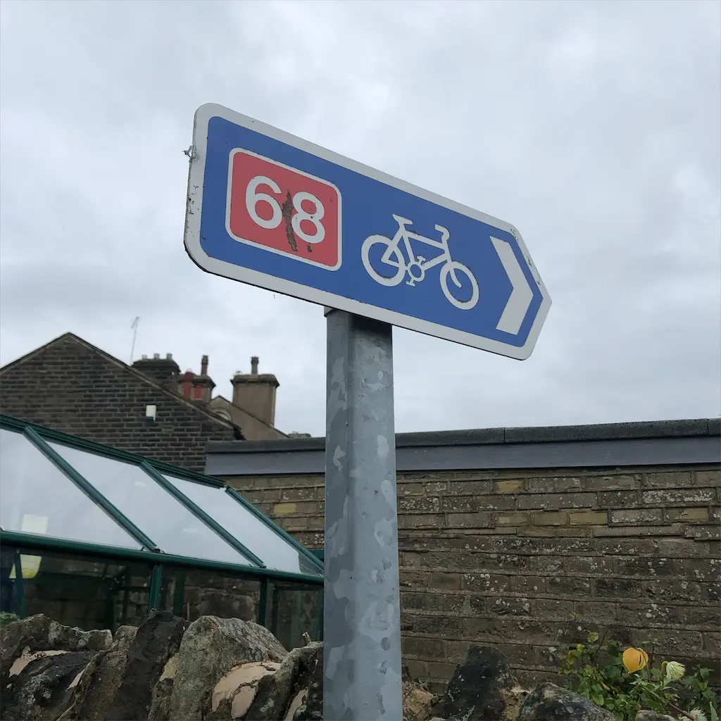
We already have a National Cycle Network (NCN). One of the things that is obvious as soon as you try and use it though is that though it is National, and made for Cycles, there are many places where it is simply not a Network. In many ways it’s like the long distance footpath network, great if you want a long ride across the country, less so if you want a decent route to a nearby town.
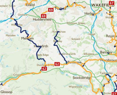
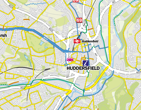
This is what it looks like round where I live. The blue and yellow lines are the signposted NCN routes. There’s an NCN route that goes almost past my door, but there’s no way marked for me to get from Holmfirth to Huddersfield for instance.
The yellow lines on that map are the “traffic free” routes and this is what the NCN/Sustrans is really good for: looking after these long distance cycle routes (often footpath and bridleways as well). I’m not going to argue that they don’t do a good job of that. This map looks much better than it would have done a few years ago.
Poking around though I find that the NCN have been removing paths from the network that don’t meet safety standards, or changing some sections to be designated for “experienced cyclists only”. I can see where they are coming from in wanting to make sure that something that has an NCN sign on it is actually a good cycling route. I know it’s really disappointing to follow an NCN route and find it subpar. But that doesn’t help when I want to travel from town to town in places that aren’t on the network.
So this is the 21st century and I have a GPS map device in my pocket. Surely I can find a technological solution to this?
Google Maps does cycling directions. I’ve tried this out on several routes and it mostly sends me the same way as a car except in town centres. It is though pretty good at sending you along NCN routes when they are available.
I’ve tried out numerous cycling route apps and the one I keep gravitating back to is Komoot, though it’s still not perfect. This is much better at getting off the main roads and onto quieter back roads. Some of that can be a bit annoying: in a hilly area it can be easier to stick on the main road, and it doesn’t seem to know where there are cycle paths on the roads and where there aren’t. Given how rubbish some cycle paths are you could debate that that’s actually a feature. The routes that Komoot gives me aren’t terrible, but they are also not the ones that local cyclists follow. And it seems they actively avoid the traffic-free bits of the NCN, probably because they are slower, but I’d rather use them where they are there than the faster roads that might be parallel to them.
One of the problems with following any sat-nav style route on a bike is making sure you have the directions when you need them. I am resistant to mounting my phone on my handlebars. I’ve done it in the past and had a mount fail and drop my phone in the road (it was undamaged). I don’t feel like I ought to need another piece of kit. I couldn’t get Komoot’s Apple Watch app to work properly and give me directions. I tried using it with voice navigation and one earpiece in but that missed turns and lost the route. My current system is to plan a route with Komoot and upload it to the WorkOutdoors watch app that then shows where I’m planning to go on my wrist. But this is a pretty clunky workflow as the Komoot phone app doesn’t let you export a GPX file directly so you need to use the website. I like having the WorkOutdoors map on my wrist though. It’s handy to glance at at a junction but out of the way the rest of the time.
Getting directions as you cycle along though would be another place where an actual signposted route network has a huge advantage! As I enter Huddersfield town centre from the Holmfirth direction there are cycle signposts telling you which way to go. Neither Google Maps’ or Komoot’s directions follow that route. Coming back there are no cycle signposts and each app sends me a different way. I haven’t figured out the best way to cycle north to south through Huddersfield and from the looks of the comments on the Safer Streets for Walking and Cycling map here I’m not the only one confused. I found this local news story from last year: “Cyclists’ champion slams Huddersfield town centre as hazardous, But help is at hand with handy ‘cut-out-and-keep’ guide and map”. Well I haven’t managed to find the cut-out-and-keep map in the online version, there’s an image of part of the town centre that doesn’t help much.
After all this I have eventually turned up the West Yorkshire Interactive Cycle Map which actually comes from Sustrans but I found via my local council rather than their own website. It has yellow roads for “advisory cycle routes” and includes all the signed cycle routes as well. This actually looks to be pretty much what I was looking for. I still can’t figure out cycling through the town centre but unlike Google Maps and Komoot it’s clear that the ring road is not somewhere you want to cycle. If I could just find something that would give directions on this network then I might be happy. I can also see several paths showing up as “cycle path/rough track” on that map which I thought were footpaths so I will go and investigate those a little more, I’m not sure they are going to prove to be sensible cycling routes though. A quick investigation shows one of them marked as a footpath on OpenCycleMap so I’m a bit dubious I guess.
I know the situation is better in some other places (well a lot better in some other countries!) but I wish all this stuff was joined up and I could get from A to B without needing too much kerfuffle with the route finding or following signs meant for motor traffic. The existence of the West Yorkshire Cycle Map (which doesn’t appear to be interactive in any other way than it’s online) makes me think that it is doable.
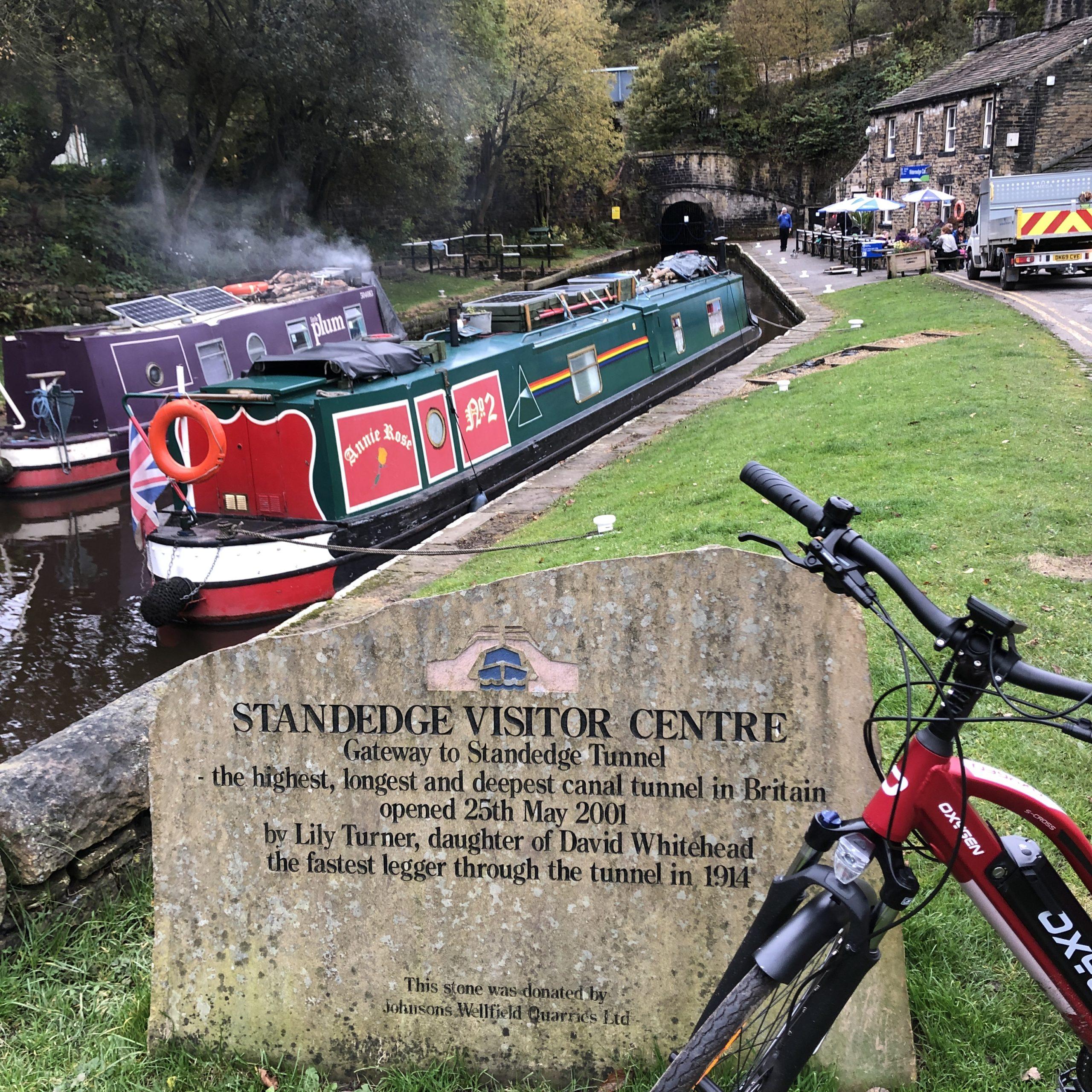
I thought I’d finish with a photo from this morning’s bike ride. Then I found it was from a traffic-free route (canal towpath) that isn’t marked as a cycle route on the West Yorkshire Cycle Map. So my conclusion is, much like the towpath, getting muddier all the time!