Foot Drawn Map
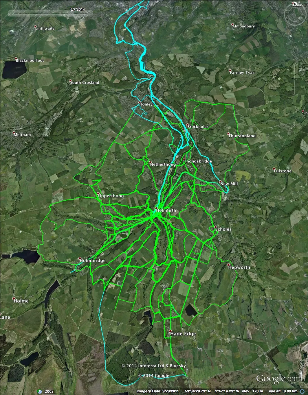
Here’s a map of Holmfirth. I’ve taken the roads off and added in everywhere I have walked and cycled [1] in the last couple of years instead.
Walking is green, cycling is blue. I tend to get bored with cycling round here as I’m not strong enough to get up the hills and we only have (relatively) flat roads along the valleys.
I try and seek out all the different paths to walk though, I don’t like to go exactly the same route again if I can think of another. I made the map in order to figure out where I haven’t walked yet. I still have a few paths to find.
Making the map made me think of Matt at I’m Just Walkin’ who is currently 5176 miles into a walk of every street in New York City. I’m not quite in that league! Most of this is just walking the long way back from dropping Miranda at school, or getting some fresh air in at the weekend.
[1] I deleted a handful of gps tracks because of clunky mapping that made in look like I’d wandered in straight lines everywhere. I’m not a crow. (And I believe they don’t fly in straight lines either.)
