A long overdue bike update
So, last time I was here, 19 months back, I had a map of all the bike rides I’d taken in the ~6 months I’d had my ebike. I was making that map by taking the GPX tracks from my watch/phone, converting them to KML and then loading them into Google Earth. Which was kind of convoluted and time consuming, and the kind of thing it’s easy to get behind on and not be bothered to catch up with.
Now I have a better solution. I upload my rides to Strava, which is close-to-automatic and from there I can let all kinds of other services show me my bike rides. I had actually signed up to Strava around a decade ago but one disparaging comment put me off using it and my account sat unused until last year. Someone asked me why on earth I didn’t use Strava and when I went back and looked it seemed much friendlier now and I decided to give it a second chance. Which meant I ended up uploading a decade plus of activities to it. While I’m here I highly recommend RunGap for moving fitness activity data between platforms, I hate feeling like I’m stuck on a platform.
So, I found VeloViewer which is a lovely, not to mention pretty cheap, service that brings in all your Strava activities and makes lovely maps and extracts great data from them. This is how VeloViewer sees my activities from the ~6 months map I posted last time:
VeloViewer
Google Earth
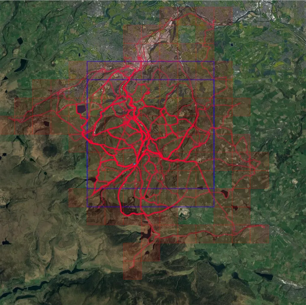
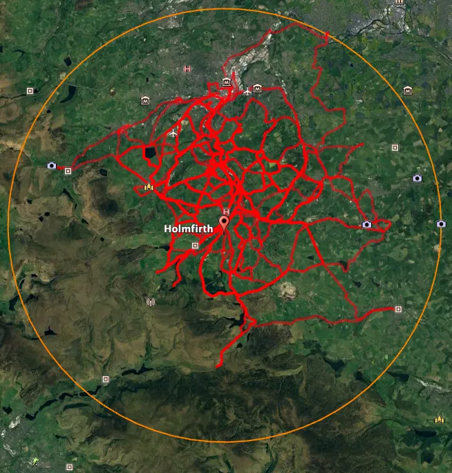
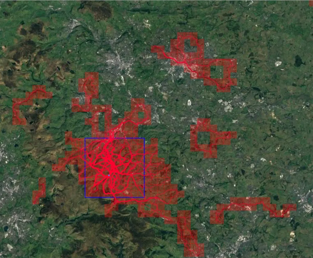
I can’t get the circle on the VeloViewer map but it does something lovely instead. It colours in every map square (approx square kilometre) that you’ve biked through. And then it also figures out the biggest square of map squares you’ve visited. Here’s a version with the colours turned up a bit and zoomed out to see another spot I’d biked in since I’m not going to keep track of which rides started from home in the future.
The reason for the two sets of blue lines is that they mark out two separate 7x7 squares on the map as I’d actually coloured in a 7x8 rectangular section of the map.
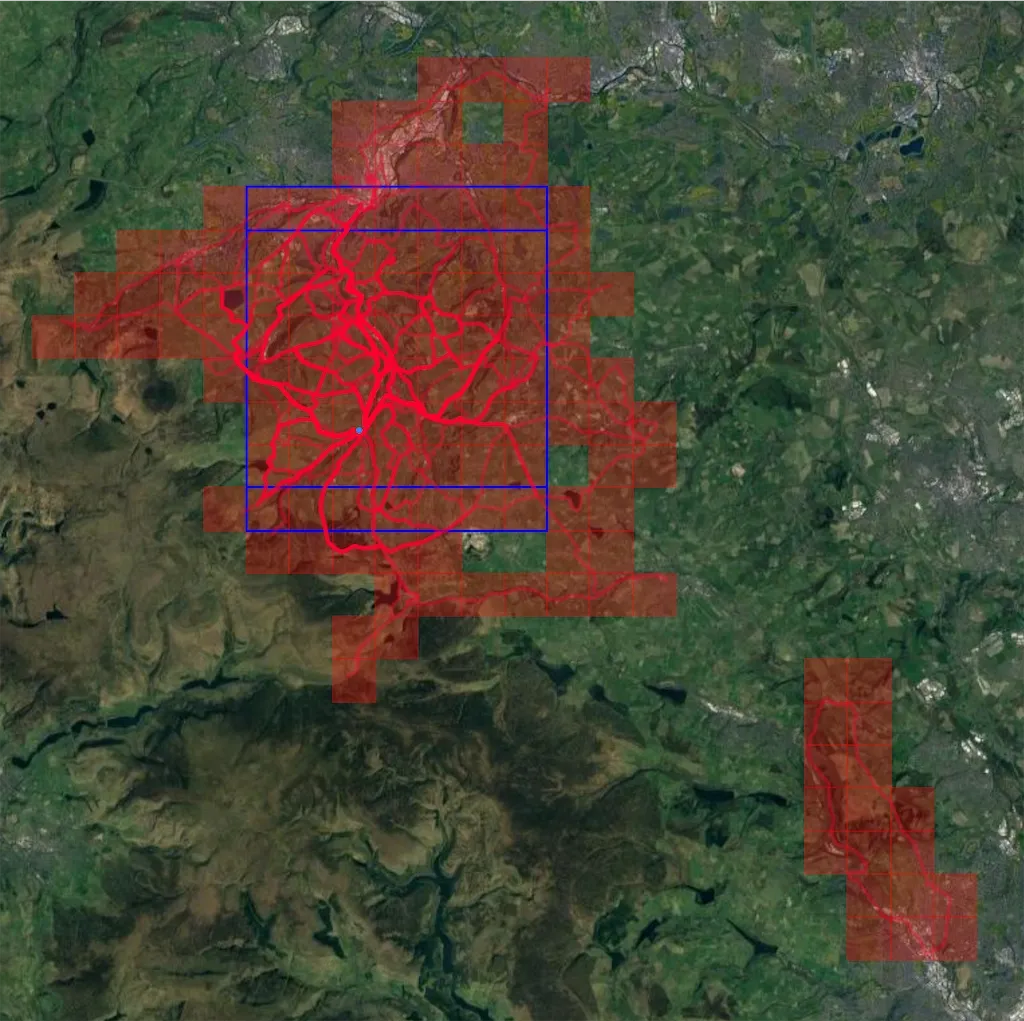
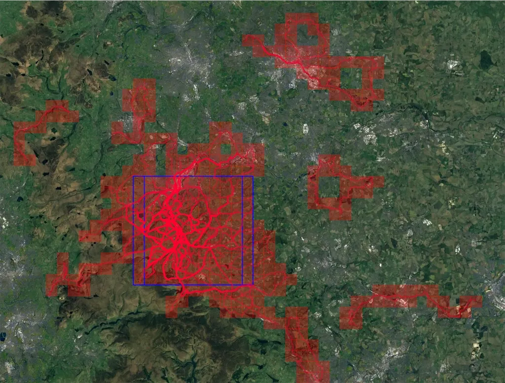
By the end of 2021 I’d cycled a lot more but hadn’t yet discovered VeloViewer so even though I’d cycled a lot further my blue 7x8 maps rectangle hadn’t expanded at all. I’ve zoomed the map out a bit to show more territory I’ve covered.
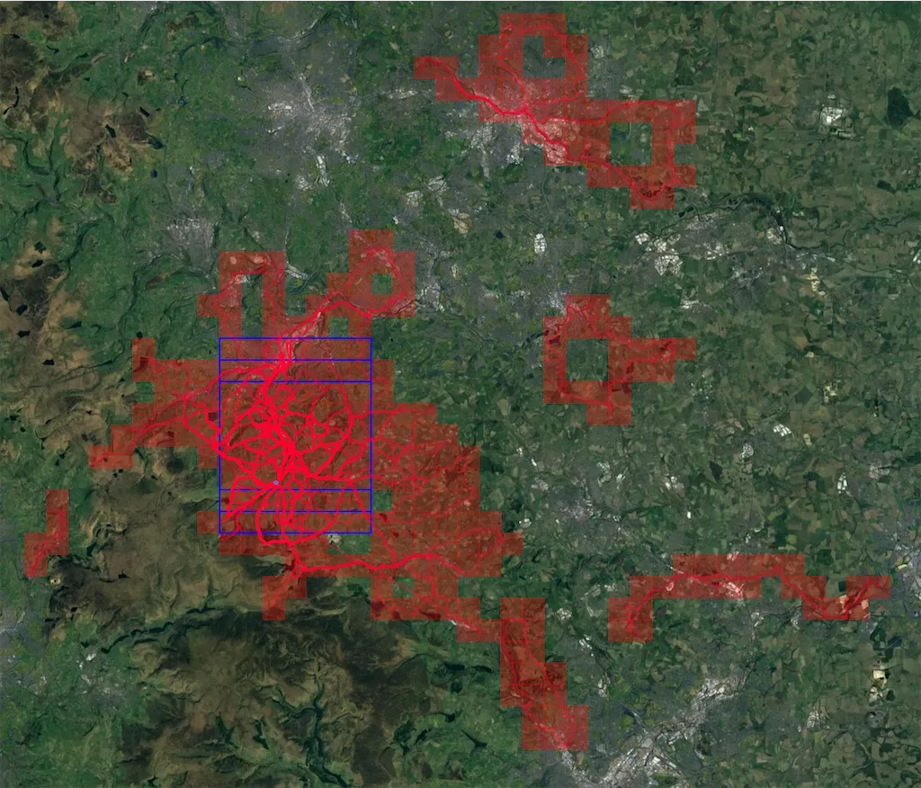
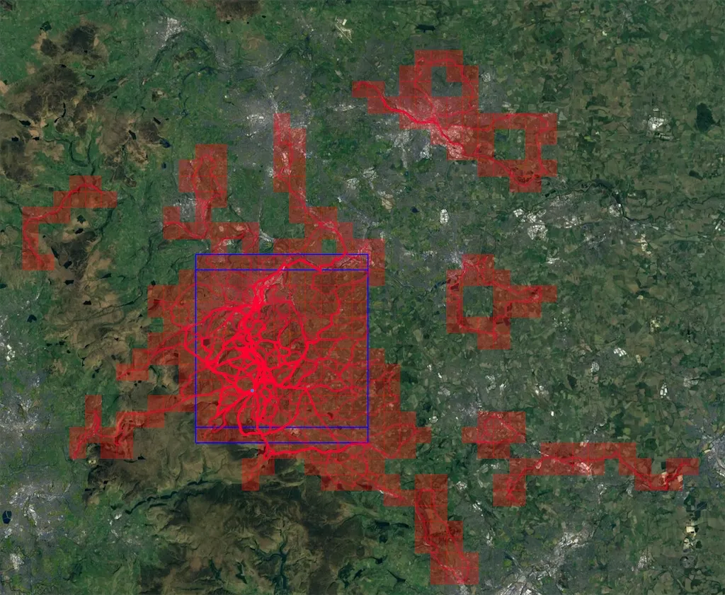
Then let’s do quarterly updates. This is as at end of March 2022. My square is now 9x9 as I filled in a few of those pesky gaps.
And by the end of June I’d got a 10x11 rectangle, so 10x10 twice over.
And coming right up to date I’m now on an 11x12, so two 11x11 squares.
I am kind of feeling like I might have exhausted this as a way to encourage myself to take longer rides, though not all of these rides have started from home so I guess I’m still encouraging myself to ride in new places and see new things which is what I enjoy.
I now feel I need to “join up” some of those isolated rides that show up as random red loops of squares on the map! There’s another statistic in VeloViewer which is about the maximum cluster of explored squares - my number is currently 142 - though I’ve apparently cycled in 444 squares altogether.
Watch out for another update in maybe less than 19 months…