Map Overlay
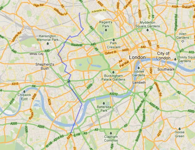
The map above shows a bike ride I took last weekend, from home to a local coffee shop. Except the ride was at home in West Yorkshire and the map shows the route taking me through London from Wandsworth, up through Kensington and Holland Park to West Hampstead. I suspect there are significantly more coffee shops on that route. I always want to do this kind of thing when walking and cycling: “If I was in [X place] how far would I have been?”. Your sense of scale changes in different surroundings, it is interesting to be able to compare them directly and easily. Created with a new tool for “cartographic mixtures” called MapFrappe; I look forward to seeing more. (The ability to rotate your outline would be my first request.)
[via As Above]